
French IGN topo maps in 3D: fly over your hiking route
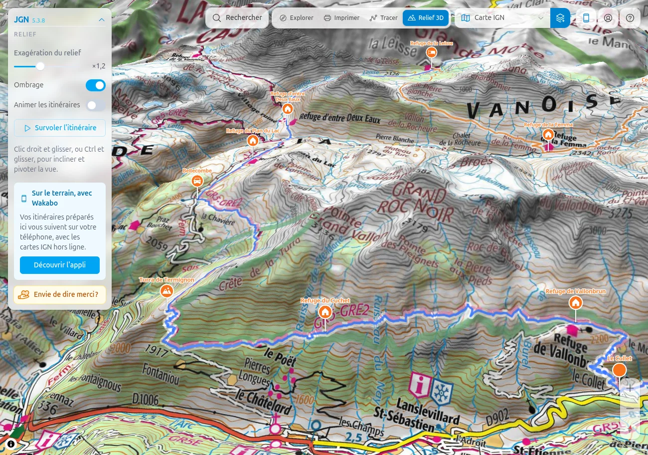
The 3D reliefBeta mode drapes the chosen base map over the terrain: you see your route in its landscape, with its passes, valleys and slopes.
Moving around
- Drag to move, scroll or + / − to zoom.
- Right-click and drag, or Ctrl and drag, to tilt and rotate the view.
- The compass, below the zoom buttons, turns the view back north and flat.
Adjusting the display
- Relief exaggeration: from ×0 to ×3, to emphasise or flatten the terrain.
- Hillshade: brings out the slopes, as on a paper map.
- Animate tracks: sends a glow running along the routes.
Flying over your route
Load a route, imported or drawn in JGN: it shows in 3D, its stages standing on a mast with their names. Click Fly along the track to travel along it as if in flight.
Discovering summits
Under Discover, pick a place (Mont Blanc, Écrins, Pyrenees, Verdon, Corsica…) to go there: the camera circles around it. Then pick Back to where I was to return to your view. Orbit takes the camera on a full turn.
What you get in 3D
- The base map and overlays you chose, including the IGN steep slopes (Pentes raides IGN), very telling in relief.
- The huts from Refuges.info, with their details on click.
- Place search.
A beta version
- 3D is for viewing: printing, drawing and the elevation profile stay in the other modes.
- The terrain comes from open worldwide data: small gaps are possible on cliffs and narrow ridges.
- The mode needs a fairly recent computer.
Feedback is welcome, from the help menu at the top right of the map.
See also
Draw a route
Learn to draw and fine-tune your route point by point.
Recent satellite imagery
The latest Sentinel-2 and Landsat images, to check for snow where you plan to walk.
IGN base maps
Carte IGN or Scan 25? Understand the differences to pick the right base map for your hike.
Refuges.info
Show the huts, shelters and water points of the Refuges.info community right on the map.