
Super Topo: one hiking map across France, Spain and Switzerland
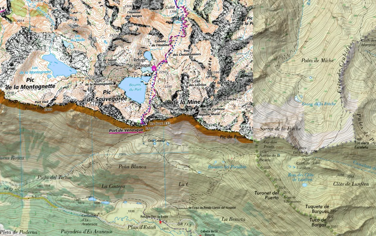
Super Topo shows, on each side of the border, the country's best hiking map: IGN's Scan 25 in France, the Spanish IGN topographic map in Spain, swisstopo's in Switzerland and Kartverket's in Norway. Handy to plan a hike that crosses from one country to another, in the Pyrenees, the Jura or the Alps.
Good to know
- The map switches tile by tile: near the border, each country's map spills over slightly into its neighbour.
- Outside France, Spain, Switzerland and Norway (Italy, Andorra, Germany...), it shows OpenTopoMap.
- In 3D relief, Scan 25 takes over in France, and OpenTopoMap elsewhere.
The maps come from IGN, Spain's Instituto Geográfico Nacional, swisstopo and Kartverket, and elsewhere from OpenTopoMap.